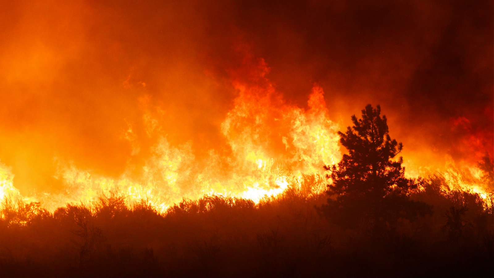
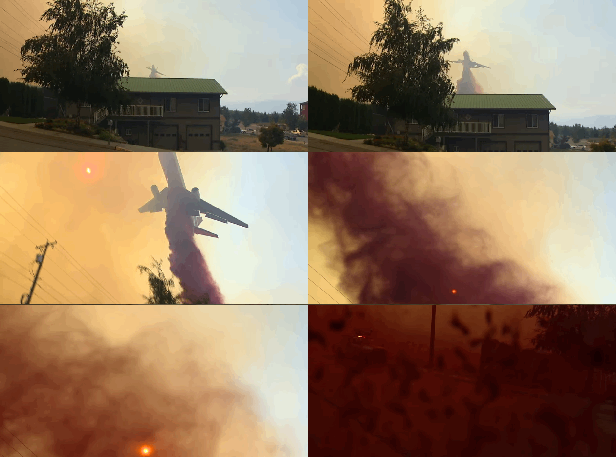
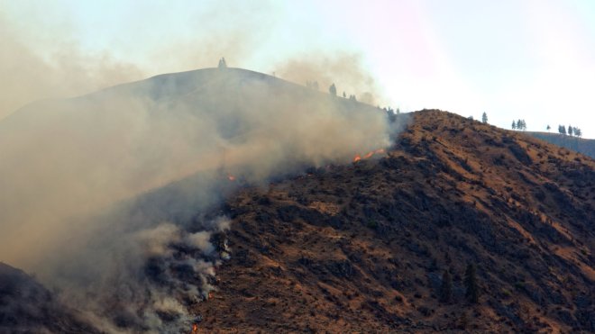
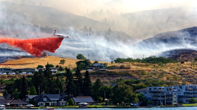
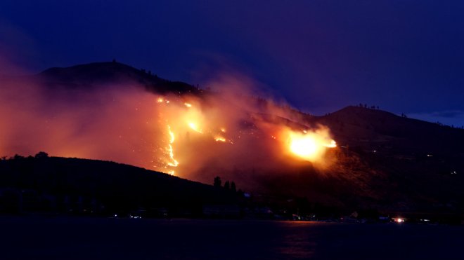
When fire came to Chelan, Wash., it arrived with all the chaos and drama of a fictional apocalypse. Crowds of tourists gathered to watch a jagged orange line of flame crawl up Chelan Butte, a giant brown hillock that pinches this small city against a namesake lake that punches 50 miles into the steep, glaciated Cascades. Then the crowd ran screaming when 40-mph winds reversed and drove the fire line toward the homes and restaurants that edge the lake.
With a big enough CGI budget and maybe Ed Harris, any Hollywood hack director could probably do the broad strokes: five separate lightning strikes setting the ponderosa forests alight, only to join later in one blaze; flinty sheriffs on bullhorns shouting out evacuation orders; a wall of smoke and fire dropping off a 6,000-foot ridge to dead-end in the fat snake of the Columbia River.
But it would take a demented genius with a gift for the unsettling comedy that underpins horror — Guillermo Del Toro or Tim Burton, maybe — to dream up the weird details that accompany what looks like The End of the World in Vacationland.
Jet skis tootling by while a turbo-prop scooper plane opens its belly to gulp up the lake; DC-10s dive-bombing the town, leaving red clouds of flame-retardant slurry billowing in their wake to coat houses, news crews, and pet dogs on the loose; embers cartwheeling across a highway in the wind gusts, seemingly delighted at the chance to ignite their own blaze.
For six weeks this summer, fire owned this valley: Fires felled power lines and exploded substations, cutting off communication with the outside world as smoke blacked the sky. Boathouses burned through the night, leaving freestanding docks and boat launches hugging an ashy shoreline. In scenes like these, it’s hard not to see wildfire as a malevolent living thing, something that stalks hungry and with purpose. When the world ends with fire and you look past the tableau of burning hillsides, the lurking metaphors of the monster movie start to stick.
From its start on the morning of Aug. 15 to its eventual containment on Oct. 1 at midnight, the Chelan Complex fire consumed over 88,000 acres, forced the evacuation of 1,600 people, charred at least 100 structures (including over 50 homes, plus an apple packing plant and a winery), required the efforts of 680 firefighters, and cost $30 million to end. And it wasn’t even the biggest in the state: That’s the 300,000-acre Okanogan fire — technically five separate blazes started by lightning strikes in the Eastern Cascades, also on Aug. 15. That one burned for a month, destroyed 276 structures, and killed three wildland firefighters.
[pullquote class=”pullquote–custom”]It’s hard not to feel that climate change is literally fanning flames across our globe.[/pullquote]
In the U.S., 2015’s devastating fire season topped 2006’s record season to become the worst on record: Over 9.8 million acres burned during a national wildfire season that extended into December. Washington state’s total burned acreage this year reached 1.1 million; Alaska broke records to reach 5.1 million acres. And it’s not just this country feeling the heat: Indonesia’s peat wildfires emitted more carbon than G8 countries, 34 people died in Siberian wildfires in April, and Canada’s summer wildfires forced thousands of people to evacuate British Columbia and Saskatchewan.
It’s hard not to feel that climate change is literally fanning flames across our globe. In a sense that’s true, but our near-record fire season — like any Godzilla worth its thermonuclear salt — arises from a convergence of complicated factors, a confluence of human error and natural terror.
And like Godzilla, it’s only sleeping. There’s even a small chance the Wolverine Fire above Chelan might still smolder underground, seething in the roots of old-growth trees and insulated by winter snows. For Washington’s wildfire season, it’s just a matter of when — or where — it will wake up.
Grist | Ted Alvarez
While the Chelan fires were still burning, I was 1,200 miles away in Colorado. But the fire found me anyway, in the form of smoke mingling with haze from other burns in Oregon, Washington, California, and Idaho. It blew in to render the usually imposing 14,000-foot Collegiate Peaks as dim shadows behind a gray-blue scrim. I’d seen fires from both my home state and afar obscure mountains before, but never this severe or from such a distance.
The fire and its possible causes landed on the national radar, too. In the media, it was all but inescapable: “Climate change fueling larger wildfires in western U.S.,” proclaimed USA Today; “Wildfires blamed on climate change; more flames, higher costs,” read CNN.com; “What megablazes tell us about the fiery future of climate change,” Rolling Stone chimed in. These fires are a literal and metaphorical flash point in the uncomfortable place where journalists, scientists, activists, and regular humans seek to understand the magnitude of climate change.
A few months out from peak season, the ground has cooled in most places, but temperatures still run high. News crews have moved on, but communities are still reeling. Fire season dies off and public attention drains away — but the science, preparation, and messaging that might help us adapt often begins when the firefighting ends.
Grist | Ted Alvarez
Now it’s October and I’ve returned to the source (one of them, anyway) just outside Chelan. I’m meeting up with U.S. Forest Service staffers Carly Reed and Jeff Bouschor. I had wanted to see what wildland fire looks like when it spills into a town where people live — and I couldn’t turn down the opportunity to see it with two people who have so much front-line experience.
As a public information officer, Reed is tasked with trying to keep heads cool — even while fire pours down hillsides to houses she knows. A native of the region, she has spent a decade working in and around these woods. Bouschor hails from Alaska and started fighting fires 22 years ago, “mostly so I could be a ski bum.” As Chelan Ranger Districts’ Assistant Fire Management Officer, Bouschor was one of the incident commanders responsible for coordinating everything from bulldozing firelines to physically redirecting fires away from barns and houses. When fire season isn’t raging, he helps direct mitigation efforts — mostly prescribed burns and mechanical thinning — with a 20-person crew and a not-enough budget.
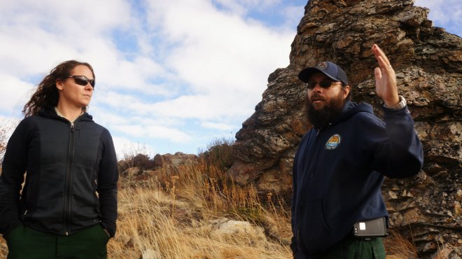
Carly Reed and Jeff Bouschor surveying the burn area.Grist | Ted Alvarez
From Forest Service headquarters, where we’re in sight of toasted Chelan Butte, we plan to drive up Washington Creek. We’ll head into the mountains and past severe burn areas to stand atop Cooper Mountain, where we’ll see miles of blackened mountains stretching to the Columbia and over into the Okanogan Complex fire. Our descent will wind down Antoine (“it’s pronounced ‘An-Twine,’ people around here are very particular about that,” Bouschor notes), where some of the worst damage to homes occurred.
Reed is steely and athletic, while Bouschor sports a big beard and a matter-of-fact, wry humor that reminds me of other born-and-bred Alaskans I’ve met. When I ask, they are quick to point out that these fires can’t be blamed on climate change alone. It’s a routine they’ve clearly memorized from talking to press all year long. Yearly weather variability and disastrous forestry practices play a part. Plus human memory is too short, or too unwilling, to recall that fires — sometimes even the colossal, catastrophic ones — are part of the engine of a montane ecosystem.
[pullquote class=”pullquote–custom”]These fires are a literal and metaphorical flash point in the uncomfortable place where we seek to understand the magnitude of climate change.[/pullquote]
“We historically have large fires of maybe 50,000, 60,000 acres,” Bouschor says. “What is uncommon is that they came into the low country and the urban interface,” the boundary zones at the edges of wildland and human development.
Like many in his profession, Bouschor points out that fire is important for ecosystem health — and is not a fan of a certain PR campaign that convinced the public otherwise. “We are always going to have fire, but we’ve been living under 70 years of fire suppression,” he says. “Smokey the Bear’s message that all fire is bad fire is not necessarily a true statement — it’s been ingrained in our psyches since we were kids. That’s slowly changing, both politically and financially. We’re learning that the ecosystem needs frequent fire.”
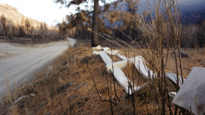
The fire burned so hot in some areas it melted metal fences into Laffy Taffy droops.Grist | Ted Alvarez
But even Bouschor and Reed can list the anomalies and extremes that have come with the area’s recent fires. For the first time Bouschor can remember, embers jumped the 2,000-foot-wide Columbia River to spark blazes on the opposite side. The Sleepy Hollow Fire destroyed 29 homes and burned a 4.5-square-mile hole into Wenatchee, a city of nearly 33,000 set away from the mountains. The prevalence of “megafires” of 100,000 acres or more is especially troubling, and these megafires tend to burn with scary intensity: Ground temperatures can top 2,000 degrees F — more than twice the surface temperature of Venus and hot enough to melt gold and granite.
That’s also hot enough to turn a normally fire-resistant, old-growth stand of ponderosa pines into burnt toothpicks and, given enough deep duff and organic biomass, burrow into giant stumps and deep root systems to hide out for the winter. Encouraged by drought and heat, that’s how one of California’s largest fires of 2014, the Happy Camp Complex, came back to life in June of this year. If the winter and spring of 2016 is as mild in the Northwest as it was in 2015 — and signs indicate that it might be close — Washington fires like the Wolverine could conceivably resurrect, too.
Seventy-five miles north of the roads we’re navigating, ecologist Susan Prichard watched last year as another massive fire gorged on 160,000 acres of forest in a single day. Prichard holds a joint appointment with the University of Washington and the USFS’s Pacific Northwest Research Station, and her home here in the Methow Valley is essentially her lab. But being so intimately acquainted with fire doesn’t insulate her from the frayed nerves it brings. Prichard couldn’t sleep when the Carlton Complex fires approached town on the night of July 17 last year, so she stayed up watching the glow on the horizon as it crept closer. That fire was the biggest in the state’s history until it was surpassed this year by the nearby Okanogan Complex. Prichard and her neighbors got another dose this year when the Twisp River Fire raged near the town of Twisp.
Prichard studies wildfire and climate change, specifically how fire regimes — the frequency of wildfire on a given patch of land — are shifting, and how ecosystems might regenerate after a fire under current conditions and as montane climates morph under global climate change.
“Under these incredibly long, dry hot summers we’re definitely seeing different levels of severity,” Prichard says. But she, too, is quick to point out that “it’s more complex than climate change.”
Prichard explains that centuries of land use decisions have left us vulnerable to more intense fires. “Moving Native Americans off the land, introducing wild cattle and sheep-grazing removed a lot of our native grasses, and logging in the past removed large trees and left lots of smaller fuels. We’ve got decades of fire exclusion, an abundance of surface fuels, and canopy layers that leave us open to [intense] canopy fires.”
But Prichard says climate change is a guiding hand, nudging us to more and bigger fires over longer time scales.
“A fair way to describe this is: Warming is happening, we know that for sure,” she says. “There is a top-down climatic control that means our fuels might be predisposed to burning [over the] next century.”
Scientists and officials at the Forest Service are plenty OK with ditching that pesky “might.” The Forest Service isn’t shy about pointing the finger and mounting an offensive: A report released in August plainly implicates climate change in increasing the fire season by 78 days since 1970, and burning twice as many acres as three decades ago — and expecting that burned acreage to double by midcentury. The cost or hours of fighting fires grew by 16 percent since 1970 to consume over 50 percent of the agency’s entire budget; they expect that percentage to rise to 67 percent by 2025. The six worst fire seasons after 1960 have all happened since 2010. Even the bland pages of a government report can’t cage the panic.
Not everyone is excited to ring the climate-panic bell, though — at least not when it comes to pinning specific fires on the global crisis. Pacific Northwest weather guru and climate lightning-rod Cliff Mass, also based at the University of Washington, is direct in his assessment. “This year you can’t blame it on global warming,” Mass says. “We’ve let our forests degrade — they burn fast, they burn hot, they’re very hard to control. Everybody in the business knows it and admits it. I do a lot of mountain biking out there, and you can see what a disaster it is. ”
Grist | Ted Alvarez
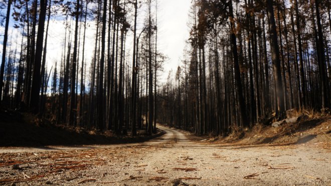
We rise up Washington Creek, pass a blaze-vested hunter (“hiking around in the woods goes hand-in-hand with people with guns, I guess,” jokes Bouschor), and pass through two kinds of forest on opposite slopes. Below us, the spaces in between tree trunks are choked with brush, saplings, and undergrowth — the kind of “disaster” Mass was talking about. On the section up above the road, the woods mirror the “park-like” forests that existed here before the westward expansion of human management and invasive species stopped the periodic healthy burns that cleared out the understory and ground cover. Tall ponderosas with sprawling limbs stand spaced apart, like players in the world’s slowest, biggest Ultimate Frisbee competition.
“In the past, native bunchgrasses left bare ground in between [trees],” Reed says. “Now it’s covered with cheatgrass, which out-competes the native bunchgrasses. It’s a bright, flashy fuel that allows the fire to spread much easier.”
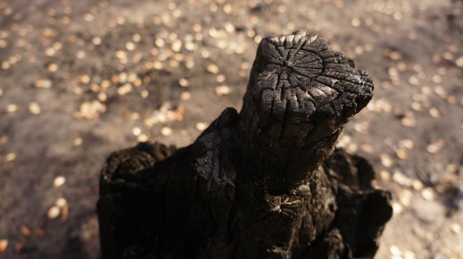
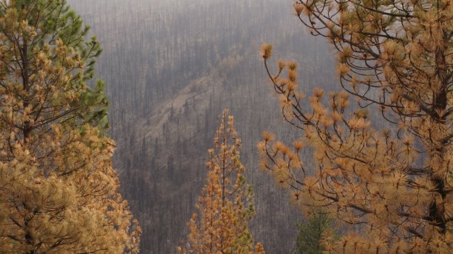
The gray government-issued Ford Explorer rounds the bend and we enter our first big burn area. But the difference between the forest above the road and below is stark: On the slopes rising above, green crowned ponderosas sprout from ashy ground; below, charred spears poke out of a rubbled moonscape. The difference? Bouschor was able to mitigate the damage to the acres above with pruning and controlled burns.
[pullquote class=”pullquote–custom”]Preventing fires rather than fighting them mirrors much of our psychological problems with climate adaptation.[/pullquote]
“Ponderosa pine can be remarkably fire resistant — if less than 30 to 40 percent of it scorches, it will most likely survive, maybe even up to 50 percent,” he says. “Around here it’s mostly a surface fire. There’s been lots of treatment in Washington Creek and you can see the results.”
Bouschor has about 90 days after fire season to complete thinning and preventative burns. Treating an acre with burns costs $90-120; thinning costs about $450 an acre. Preventing fires rather than fighting them mirrors much of our psychological problems with climate adaptation: Money dries up fast for preparedness; it’s easier to get the tap flowing in the urgency of crisis, even though 1) it’s more expensive, and 2) it might be too late.
This despite the fact that more and more Americans are choosing to live at the edges of fire-prone forest lands. By some measures, the steadiest population growth in the country occurs in the mixed zone where civilization threads its way into natural habitat. Several factors — quality of life, available land — are driving growth into this “wildland urban interface,” where prolonged drought, a legacy of mismanaged forests, and climate change will conspire to bring more catastrophic fires. Fifty to 70 years ago, no one lived there; now, a third of the country does. Protecting everyone will be virtually impossible.
Bouschor tries to target valleys and drainages that lead to homes and structures, but predicting ideal sites to protect from megafires is tricky business.
“If a wildfire occurs where there have been fuel treatments, it’s easy to say those fuel treatments were worth it,” says Prichard. “But it’s hard to know if you’ll have wildfire in the amount of time that your treatments are effective. We just don’t know where and when [wildfires] are going to occur.”
Grist | Ted Alvarez
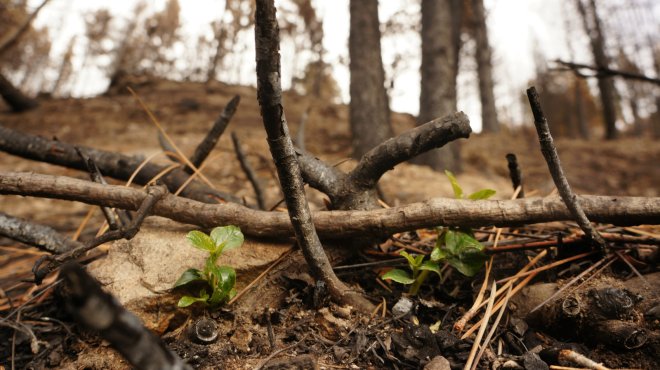
We rise into a forest of leafless trees with trunks that are blasted like burnt toast. At the base of a set of trunks that are splayed out like a dead spider, green shoots of scholar’s willow are already popping out of the ash. “Next spring, pine seedlings and grass will be back and it will be quite beautiful,” says Bouschor. “It’s far from a dead zone — deer and all kinds of animals are attracted to edge habitat.”
Reed explains that Forest Service recovery teams are dispatched to burn areas to assess severity and subsequent risk for flash flooding: Soil’s ability to absorb water is inversely proportional to how scorched it is. During major rain events, ashy, hydrophobic soil can send torrents downhill to obliterate houses downstream. The National Weather Service is in the process of installing early-warning systems at the top of peaks; we crest Cooper Mountain to find one — basically an antenna and weather vane on a metal pole encased in concrete — at the top.
[pullquote class=”pullquote–custom”]”I absolutely believe attention is warranted by these fires. It’s a problem in the entire western U.S. — and it’s everybody’s problem”[/pullquote]
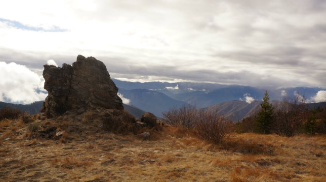
We pull over next to a natural rock monolith and hop out in hopes of seeing the full extent of the fires that spread through the mountain valleys radiating out from the summit. The capricious clouds of the Pacific Northwest aren’t cooperating; there’s sun on us, but tendrils of fog curl into the valleys and over peaks. In the breaks I can catch hints; swatches of black that connect to others I see in cloud holes miles and miles away.
“When you look at imprints of past fires, it was like a patchwork quilt,” says Prichard. “But many of these are abutting and vast, so one of the interesting ideas is that as we get more and more fire they’ll be self regulating. Less fuels means less-intense fires, or simply not enough to burn. Past fires become barriers.”
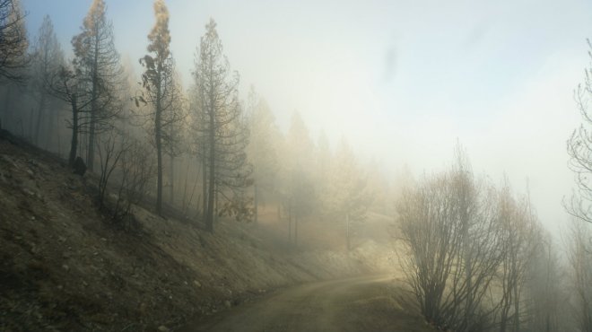
We follow the bulldozed fireline into Antoine Creek, which holds one of the hardest-hit communities outside Chelan. Firelines need to be half as wide as flames are tall to have a hope of stopping a blaze; that means I’m cruising through a spot where a 40-foot-high wall of fire came through. Fog smudges the ghost forest as we drive along; it gives us the illusion that we missed the fire by a few hours and we’re driving through the smoky aftermath.
The Antoine Creek fire started low and moved up, so it gets worse as we descend: Blasted ash and a forest whittled down to singed fenceposts choke a small basin. A crumbling chimney marks where a “real nice house” once stood. A melted metal farm fence squiggling over a ridge looks like pulled taffy. Fire movement is measured in chains per hour: One chain equals 66 feet. At its fastest, the Antoine Creek fire tore through 68 chains an hour. “That’s about the point when you start measuring it in miles per hour,” said Bouschor.
But there are firefighting miracles here, too: Untouched homes sitting in a field of ash; a cabin, stables, and grazing horses plopped on a dewy green patch of grass in what looks like the Sea of Tranquility. I sigh at the severe concrete and rusted metal of what looks to me like a blown-out house; it turns out to be an unscathed example of modern architecture. “Oh no, we saved that one,” laughs Bouschor.
Grist | Ted Alvarez
It’s impossible to discuss wildfire and the West without addressing the ‘new normal’ issue: Activists, politicians, and scientists continue to slap-fight over how much climate change can be directly attributed to any one wildfire, or to a state’s record season, or even to global carbon emissions. The complex reality of hard science crashes into our desperate need for a message that attaches urgency to a distant-but-dire crisis for our species. Wildfire becomes the latest example of “climate change today” — which is totally true, and isn’t.
Not surprisingly, Cliff Mass aggressively prioritizes data over messaging. It’s led to Mass butting heads with climate scientists and activists. “We all know what’s going on here — people worried about global warming want something now to get people to do the right thing, so they’re [focusing on] the forest,” he says. “It’s a serious issue, but it has to be based on truth — we can’t be telling things based on lies.”
But others disagree, or at least worry that quibbling with the urgency of the message bolsters the credibility of deniers and undermines efforts to get people to give a damn:
“It’s splitting hairs, as scientists often will, to note that we may not know conclusively whether climate change has caused this particular drought and these specific wildfires,” UC Berkeley’s Max Moritz told the LA Times. “As a wildfire scientist, I find it troubling that this nuance became front-page news because it implies more uncertainty about climate change than there really is among experts. In fact, there is relatively strong agreement among fire scientists about links between climate change and wildfire, even if quantitative attribution poses challenges. To raise awareness about climate change and to reduce its long-term impacts, we need our leaders to speak out.”
Even with quibbles, Mass shares a message that remains potently frightening. “This year for the summertime is a really good analogue for what it will be like — it’s so close to what we expect conditions to be in 2070,” he says. “It’s extremely valuable to see what 2070 looks like — that way we can fix it now.”
For Chelan and all the other communities hit hard by fire this year, 2070 came in 2015. And there will be more and more of those years as the century grows long. Bouschor and Reed lived it and fought it; they can feel it getting closer even if breaks between bad years come along.
“I absolutely believe attention is warranted by these fires,” Bouschor says. “They’re getting more frequent. It’s a problem in the entire western U.S. — and it’s everybody’s problem, that’s what it comes down to. We’re no longer saying, ‘Oh, it’s just burning in the Back 40,’ and people are complaining about the smoke. It’s in people’s yards and homes and livelihoods. To me the most important message is getting the word out to the public to create defensible space. The forest is renewable and replaceable — livelihoods, not so much.”
Grist | Ted Alvarez
As we exit Antoine Canyon and approach the Columbia River, we turn on Highway 97 and approach a rocky bluff towering 800 or so feet above the river. On the banks under the bluff, Reed and Bouschor and all the other people fighting gathered at an incident command center. From here the fire poured down the cliff toward HQ, lighting up the night and creating a perfect darkest-before-dawn moment for our heroes battling an approaching monster.
“We had everybody helping,” Bouschor says. “When fire started spotting across this highway, helicopter pilots were using water meant for dust abatement to spray down and protect structures.”
“It was unnerving, seeing [the fire] so close to where we were, after a day of seeing DC-10s doing hot laps, laying retardant over a city with people running and screaming,” Reed says. “But it was also kind of beautiful.”
“It was like a movie.”
The winter of 2015/2016 is off to a wetter, colder start in the Pacific Northwest than at this time last year. Reservoirs are filling up, and skiers bruised from last winter’s worst-in-memory season are exhaling in relief at the presence of snow. It’s probably too early to know if it’s enough snowpack to blunt the fire season, or snuff out the remnant coals slumbering in the Wolverine fire. But nature loves a horror sequel as much as Hollywood. And while we don’t know precisely when or where it will strike next, everyone knows one thing for sure: The monster will be back.

