In April, Penn State’s Earth System Science Center released its predictions for the 2020 Atlantic hurricane season. The bottom line? It was shaping up to be one of the most active hurricane seasons on record. A month later, the National Oceanic and Atmospheric Administration’s annual Atlantic hurricane forecast confirmed Penn State’s prediction, saying that the nation should prepare for between 13 and 19 named storms — an abnormally active hurricane season.
Well, it’s not even September, and we’ve already seen 13 named storms. Thanks to the possibility of a La Niña weather pattern and ocean water warmed by rising global temperatures, we may be on track to eclipse the record hurricane season of 2005, when 28 named storms formed in the Atlantic. (A storm must have sustained winds of at least 39 miles per hour to get a name.)
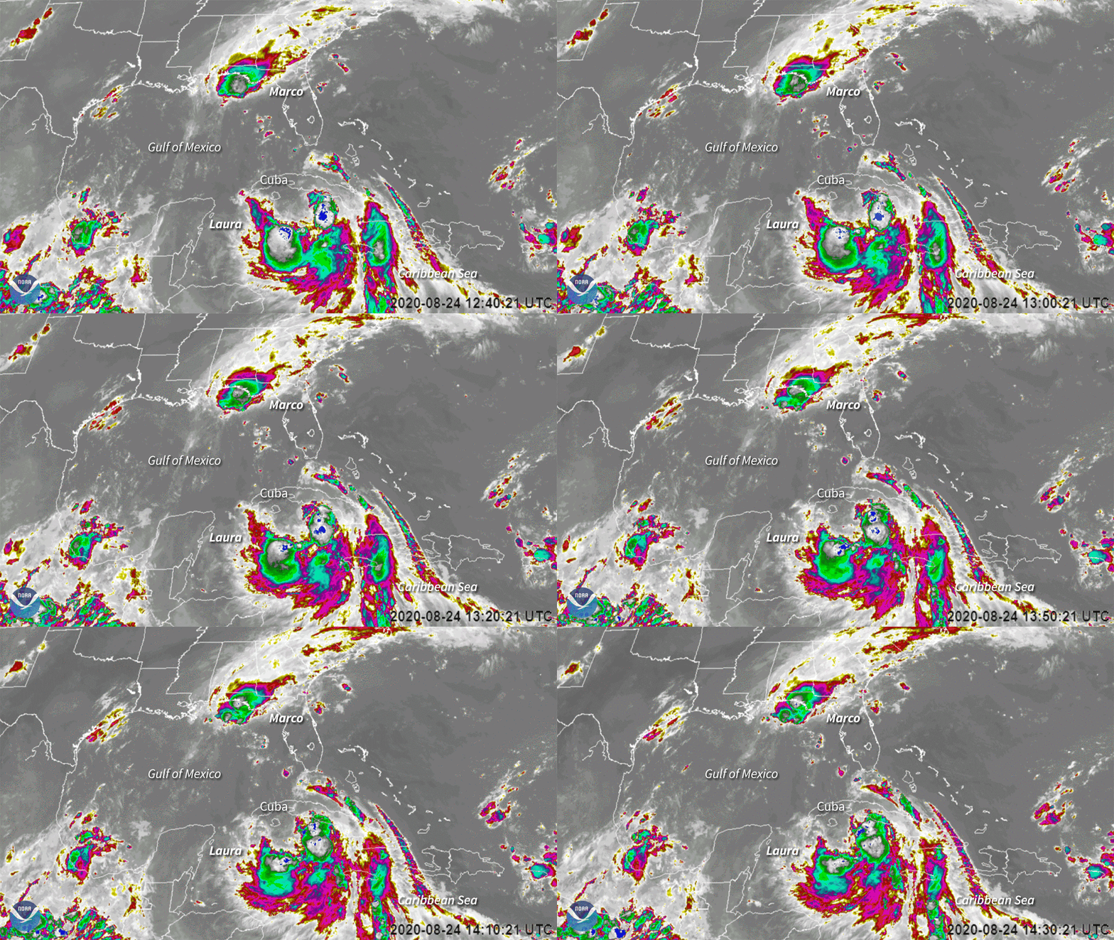
Early Tuesday morning, post-tropical cyclone Marco — which briefly became a hurricane over the weekend before falling apart — made landfall near the mouth of the Mississippi River. Hurricane Laura, the fourth hurricane of the season, is predicted to hit the Gulf Coast as a Category 3 hurricane — just a few days before the 15th anniversary of Hurricane Katrina. The storms, both of which formed on Friday, are the earliest “L” and “M” named storms on record. (Atlantic storms are named in alphabetical order.)
Offline Texas refineries in Hurricane Laura’s path will emit millions of pounds of pollution
“Both of these storms pose a flooding threat to the Louisiana coast regardless of whether they weaken or not,” Michael Mann, a climate scientist and one of the Penn State forecasters, told Grist on Monday. “The Gulf of Mexico is bathtub-hot right now, which means that these storms contain huge amounts of moisture in them, which allows for record flooding.”
The earliest “L” and “M” named storms aren’t the only records this hurricane season has broken so far.
- On June 2, one day after the official start of the Atlantic hurricane season, the third named storm of the season, Cristobal, formed over the Bay of Campeche — the earliest “C” named storm on record. That storm traveled all the way into Wisconsin, becoming the first storm on record to blow that far northwest in North America in recorded history.
- On July 5, Tropical Storm Edouard became the earliest “E” storm on record. It formed in the North Atlantic Ocean and grazed Bermuda before dissipating over open water.
- A few days later, on July 9, Tropical Storm Fay became the earliest “F” storm on record. Fay made landfall in New Jersey a day later about 10 miles from Atlantic City.
- On July 22, Tropical Storm Gonzalo formed in the Atlantic basin and became the earliest “G” storm on record. Forecasters briefly thought it would become the first hurricane of the season, but it weakened before it hit the Carribean.
- Two days later, on July 24, a disturbance brewing in the Gulf of Mexico was designated Tropical Storm Hanna, the earliest “H” storm on record. Hanna strengthened into a hurricane before making landfall in Texas on July 25, bringing 90 mile per hour winds, flooding, and storm surges with it.
- On July 30, Tropical Storm Isaias became the earliest “I” storm on record. After hitting the Dominican Republic, Isaias strengthened into the season’s second hurricane. It hit the Bahamas and then churned up the East Coast, leaving people in the dark from North Carolina to New York.
- On August 13, Tropical Storm Josephine became the earliest “J” storm on record. It brought rain to the northern Leeward Islands, the Virgin Islands, and Puerto Rico before dissipating.
- On August 14, Tropical Storm Kyle became the earliest “K” named storm on record — beating out 2005’s Katrina. Kyle spun out over the North Atlantic and didn’t have any impacts on land.
This month, NOAA ratcheted up its total hurricane season forecast to between 19 and 25 named storms including seven to 11 hurricanes. The agency has never predicted that many named storms before — a fitting tribute to a season that can’t seem to stop breaking records.


