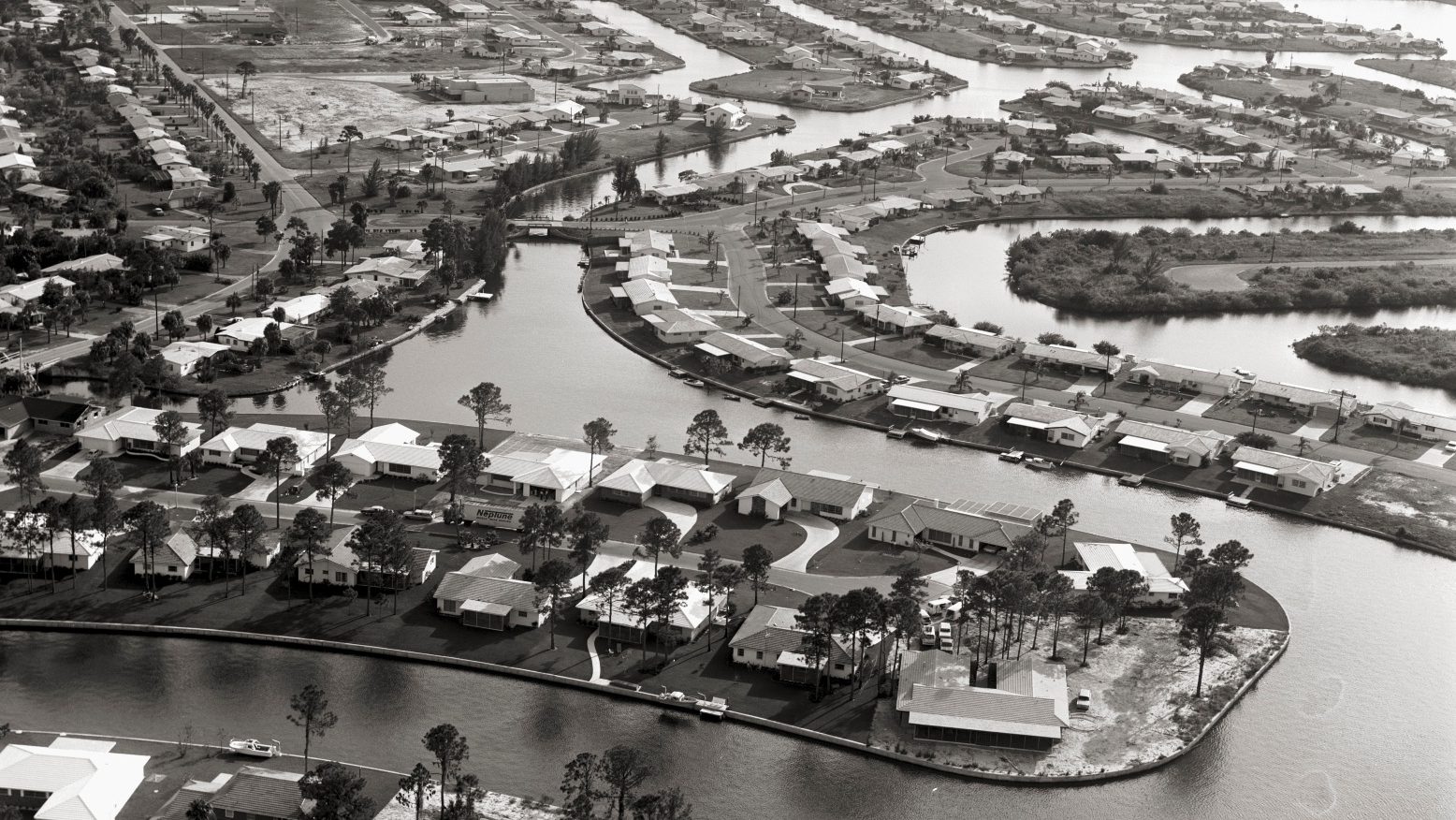
A century ago, the coast of southwest Florida was a maze of swamps and shoals, prone to frequent flooding and almost impossible to navigate by boat. These days, the region is home to more than 2 million people, and over the past decade it has ranked as one of the fastest-growing parts of the country. Many of those new homes sit mere feet from the ocean, surrounded by canals that flow to the Gulf of Mexico.
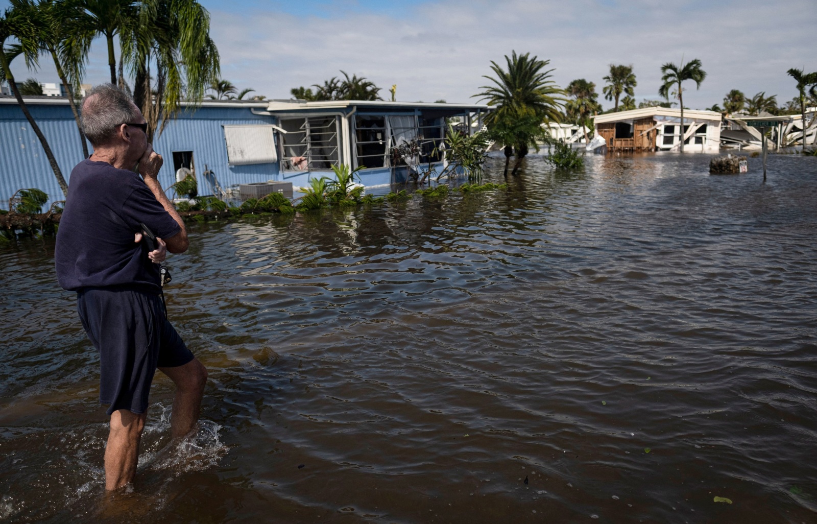
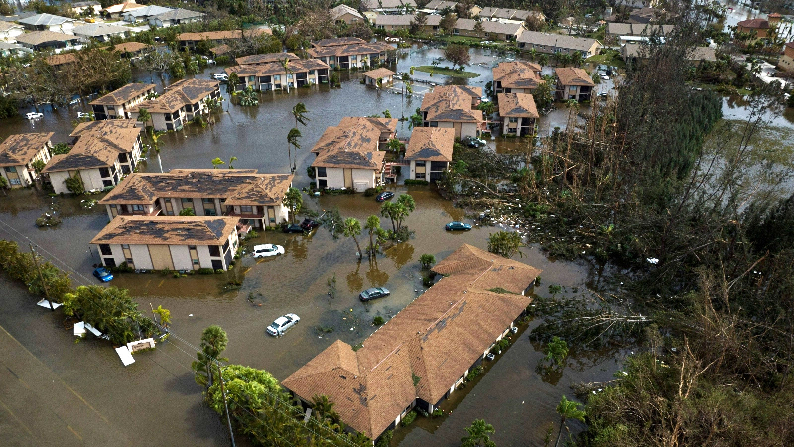
When Hurricane Ian struck the region on Wednesday, its 150-mile-per-hour winds and extreme storm surge smashed hundreds of buildings to bits, flooded houses, and tossed around boats and mobile homes. Cities including Fort Myers and Port Charlotte were destroyed in a matter of hours.
These vulnerable cities only exist thanks to the audacious maneuvers of real estate developers, who manipulated coastal and riverine ecosystems to create valuable land over the course of the 20th century. These attempts to tame the forces of nature by tearing out mangroves and draining swamps had disastrous environmental consequences, but they also allowed for the construction of tens of thousands of homes, right in the water’s path.
“What this is basically showing us is that developers, if there’s money to be made, they will develop it,” said Stephen Strader, an associate professor at Villanova University who studies the societal forces behind disasters. “You have a natural wetland marsh … the primary function of those regions is to protect the inland areas from things like storm surge. You’re building on top of it, you’re replacing it with subdivisions and homes. What do we expect to see?”

The root of southwest Florida’s vulnerability is a development technique called dredge-and-fill: Developers dug up land from the bottom of rivers and swamps, then piled it up until it rose out of the water, creating solid artificial land where there had once been only damp mud.
This kind of dredging began well before Florida’s postwar real estate boom, when the state’s agriculture and phosphate mining industries wanted to control inland flooding, create navigable pathways for boats, and cut paths for rainwater to flow into the Gulf of Mexico. As a result of these efforts, the flow of water to the coasts from Florida’s soggy inland became tame and predictable, and the channels gave boats direct access to the Gulf of Mexico. Developers began to see the southwest coast as a perfect place for retirees and soldiers returning from World War II to settle down — they just had to build houses for them first. They carved existing swamps into a dense network of so-called finger canals, then used the extra dirt to elevate the remaining land, letting the water in.
“Dredge-and-fill became the established method to meet the growing postwar demand for waterfront housing,” wrote three historians in a 2002 historical study of southwest Florida’s waterways.
The most infamous developer to use this method was Gulf American, a firm founded in the 1950s by two scamming brothers named Leonard and Jack Rosen who had also sold televisions and cures for baldness. Gulf American bought a massive plot of land across the river from Fort Myers, cut hundreds of canals in it, and sold pieces of it by mail order to retirees and returning veterans up north. The result was Cape Coral, which the writer Michael Grunwald once called “a boomtown that shouldn’t exist.”
“Though the main objective was to create land for home construction, the use of dredge-and-fill produced a suburban landscape of artificial canals, waterways and basins,” wrote the authors of the 2002 survey. “The canals served a number of purposes, including drainage, creation of waterfront property as an enhancement for sales, access to open water for boating, and a source of fill material for the creation of developable lots.”

The three Mackle brothers, who owned another prominent firm called General Development Corporation, adopted a similar technique on other sections of Florida’s Gulf Coast. They developed more than a dozen communities across the state, including Port Charlotte, North Port, and Marco Island, all of which fell inside Ian’s radius as it made landfall on Wednesday. In all these cases, development involved carving up coastal swampland, creating a canal network to drain out excess water, and building houses on the land that remained.
“It’s just the same reason why golf courses have lots of water hazards — the big holes that they dig out to put soil on the land and make the fairways become lakes,” said Strader. “And now everybody’s got a waterfront property … but it also means you get more water intrusion.”
Backlash over the environmental impacts of dredge-and-fill eventually led to restrictions on the process in the 1970s. The public grew outraged at the idea of chemicals and human waste running off from residential canal systems into the ocean. That didn’t stop new arrivals from rushing into canalside developments like Cape Coral, which grew by 25 percent between 2010 and 2019. It helped, of course, that southwest Florida saw very few hurricanes over the second half of the 20th century. Only three hurricanes have made landfall in the region since 1960 (during which time the sea level off Fort Myers has risen about eight inches), and none of them caused catastrophic flooding.
Hurricane Ian brought that reprieve to an end, bringing home the consequences of risky development in the same way Hurricane Ida brought home the consequences of coastal erosion last September. When Hurricane Ida rampaged through the Louisiana coast, it drew attention to the deterioration of that state’s coastal wetlands, which had long acted as a buffer against storm surge. In southwest Florida, something different has happened: Not only did developers clear the wetlands, but they also pushed right out to the water’s edge, leaving just inches of space between homes and the Gulf’s waters. With sea levels rising and catastrophic storms growing more common, the era of constant flooding has started again — this time with millions more people in the way.


